
Map Lubbock Neighbors on a Block
The public record can describe the land around a Lubbock address, but each source has a specific role. The City Parcel Viewer shows spatial relationships. LCAD Advanced Search adds the appraisal-account details. County instruments can document a transfer trail, while the City’s permit search can supply dated address context. None of those sources is a complete list of people at a house.
| Block Source | What It Shows Nearby | How Lubbock Access Works |
|---|---|---|
| City Parcel Viewer and ParcelMap | Parcel shapes, address points, centerlines, footprints, subdivision, ZIP, city limit, county layers | Public map and REST layers; verify owner information with LCAD |
| LCAD street or ZIP search | Owner, situs, mailing address, appraisal account, legal description, tax year, exemptions | Public Advanced Search, phone, email, or in person |
| County Clerk EagleWeb | Grantor, grantee, recorded date, reception number, and legal description | Public index, clerk counter, archives, and copy request |
| City Citizen Self Service | Address-keyed permit number, project, type, status, and attention reason | Public search with Public Information Act fallback; sealed plans have limits |
| LUCA association layer and HOA certificates | Association boundary or management-certificate location | Public geography and state search, not a member roster |
| Historic directories | Past listed households or businesses at an address | Mahon, Texas Tech, library databases, or archives |
Use the table as a division of labor. GIS answers where the parcels are. LCAD indicates the current listed owner and land-account details. EagleWeb helps trace recorded parties. Historic directories can show a dated listing. A renter, guest, family member, utility customer, or delivery recipient may not appear in any of them.
Choose Lubbock Neighbor Parcels
The adjacent-parcel method begins with one verified address and expands only to the lots that actually touch it or sit immediately across the street. Zoom far enough in the City viewer to see parcel edges and street centerlines. A visual block can be split by an alley, a subdivision boundary, a city boundary, or a ZIP polygon, so the map view matters before names are compared.
- Search the target address in the City Parcel Viewer and select the correct address point or parcel polygon.
- Turn on Address, Parcel, Building Footprint, Street Name, Subdivision, City Limit, ZIP Code, and Lubbock County layers.
- Click each contiguous parcel and the property immediately across the street. Note the situs, parcel geometry, subdivision, lot or block, ZIP, and any city or county boundary.
- Use LCAD to verify the current owner, mailing address, legal description, and tax year for each selected parcel.
- For a full named-street record chain, move to the Lubbock By Street directory rather than treating one block as the entire corridor.
The flow is address to parcel, parcel to adjacent parcel, adjacent parcel to LCAD account, then account to a dated county instrument when a transfer question remains. City GIS receives monthly LCAD parcel uploads, so the appraisal district is the stronger source for the current ownership account and the map is the stronger source for spatial context.
Insider tip. Record the legal description and situs with each neighbor parcel. The owner mailing address can point somewhere else and is not proof that the named owner lives at the property.
Read Lubbock Neighbor Boundaries
Parcel edges do not always match the way a person describes a neighborhood. City centerlines can distinguish a city street from a county road. A City Limit layer can show that a nearby Lubbock mailing address lies outside incorporated limits. ZIP polygons add another boundary, but the USPS address tool remains the authority for a delivery ZIP. Subdivision and platted-subdivision layers help translate the map into a lot and block for deed or plat work.
The Lubbock ParcelMap layer list identifies the address, parcel, subdivision, flood, city-limit, ZIP, and county layers available for block research.
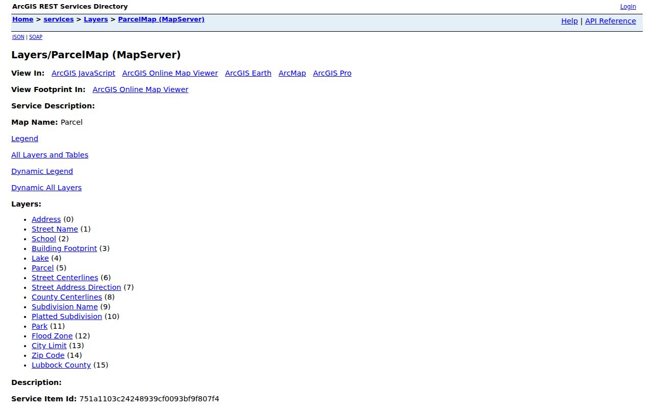
The layer choices make it possible to check the setting around a target lot before opening an appraisal account. Flood, school, park, and building-footprint layers describe geography or structures, not the identities of neighbors.
City maps also publish official street names, block ranges, and historical annexation maps. For older addresses, compare those maps with lot and block information instead of assuming the present city label or number format always applied.
Confirm Lubbock Neighbor Owners
After GIS identifies the nearby lots, use LCAD’s owner, street, ZIP, neighborhood, legal-description, or block and tract fields to inspect the associated accounts. The current account can show a property ID, CAD ID, owner name, situs address, owner mailing address, appraisal values, exemptions, property type, and legal details. Save the tax year with the result because appraisal records change.
A homestead exemption can be an owner-occupancy signal because a qualifying owner must own and live in the residence. It still does not prove every household member, a year-round presence, or the absence of another resident. The County Clerk’s EagleWeb help explains Grantor, Grantee, date-range, reception-number, and document-type searches for the next step when a recorded transfer matters.
When an address does not resolve cleanly, start from the appraisal legal description. The City subdivision layers, County Clerk plats, and Texas Tech lot surveys can bridge lot, block, and subdivision changes. A map click is a locator, not a title certificate.
Set Lubbock Neighbor Voter Limits
The Secretary of State’s voter service is designed to check one voter. Its name route uses first and last name, county, date of birth, and ZIP; other routes use a VUID or a qualifying identification number. A result may show registration status, precinct, and election information. It does not offer a verified official screen for every voter at a group of adjacent Lubbock addresses.
Myth: Parcel neighbors can be converted into a public voter list by entering the street. Texas does not provide that through the individual lookup. A Chapter 18 voter-list request is a separate county procedure, and the current Lubbock form, price, and delivery format were not identified in the research. SSN, DPS numbers, telephone data, qualifying confidential addresses, and Attorney General Address Confidentiality Program records stay protected.
Use the Texas voter lookup guidance for the individual search methods and its explanation of suspense status. A protected or unavailable result is not a cue to search around the restriction.
Use Lubbock Neighborhood Association Boundaries
The City’s LUCA Neighborhood Associations layer adds community geography without turning it into a resident directory. It can help identify the association name tied to a parcel’s area, then direct a researcher to an association’s separately published contact route when one exists. The layer itself has boundaries and names, not household membership or private contact lists.
| Association Resource | Lubbock Coverage or Example | Public Directory Status |
|---|---|---|
| LUCA Neighborhood Associations | City polygons include Arnett Benson, Ballenger, Baylees-Atkins, Blue Sky, Bowie, Caprock, Carlisle, Chapel Hill, Chatman Hill, Clapp Park, Clayton Carter, Guadalupe, Harwell, and Heart of Lubbock | Boundary and association-name layer only |
| Allen Farms Lubbock HOA | Management-certificate example in ZIP 79423 | Member directory not located |
| Viridian Lubbock Homeowners Association | Management-certificate example in ZIP 79423 | Member directory not located |
| Orchard Park HOA of Lubbock | Management-certificate example in ZIP 79423 | Member directory not located |
| Whisperwood Home Owners’ Association | Management-certificate example in ZIP 79416 | Member directory not located |
| La Colonia Homeowner’s Association | Management-certificate example in ZIP 79415 | Member directory not located |
The City neighborhood-association layer is the official source for the polygon resource and visible association names.
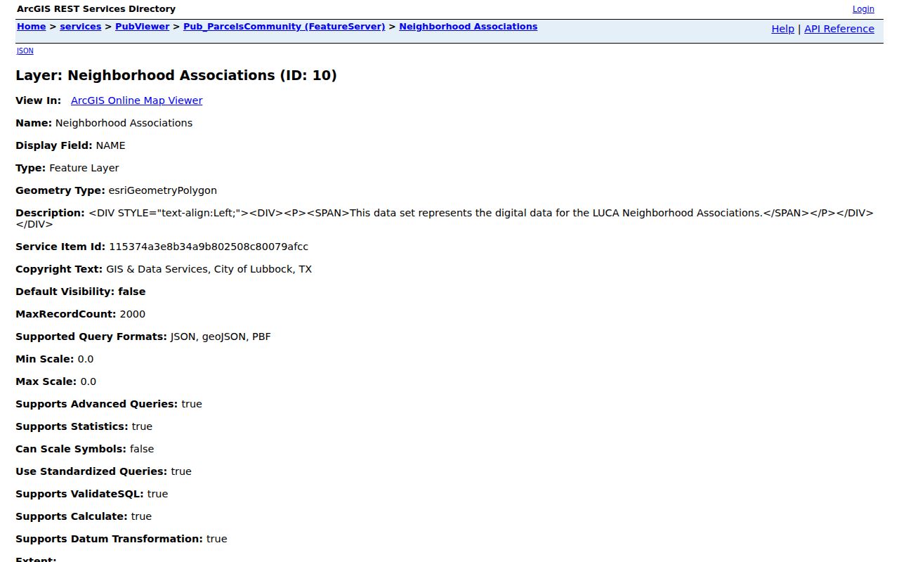
Use a boundary as context for a block, not as a claim that every household participates. The same caution applies to civic, congregation, and block-watch lists, which are usually private or opt-in.
Check Lubbock HOA Certificates
The Texas HOA management-certificate search can be filtered by association name, county, city, and ZIP. It is useful for finding a management-certificate record or association location that relates to a Lubbock block. The state warns that the database relies on user submissions and that completeness, reliability, and validity are not guaranteed.
Use the certificate as a route to a management contact or governing document. It does not establish who belongs to the association, who lives within its boundary, or who occupies a particular property. If the association publishes a public contact page, use that channel rather than seeking private membership lists.
Trace Historical Lubbock Neighbors
For an older block, address listings in Hudspeth’s Lubbock City Directory, 1930 through 1972, and R.L. Polk’s run, 1973 through 2003, can supply dated household or business clues. Search the reverse or criss-cross section by address, then check the alphabetical entry and that edition’s abbreviation key. A listed household head is not necessarily every occupant.
Mahon Library, South Plains Genealogical Society, and the Texas Tech Southwest Collection provide local-history access when a directory scan is unavailable. Pair a directory year with a deed, plat, census schedule, obituary, or lot survey before deciding that a name belongs to the same person or structure. The street directory is the better route for a whole-street chain; this block approach stays focused on the parcels immediately around one address.
Respect Lubbock Neighbor Privacy
Renters, other household members, utility customers, delivery recipients, juvenile records, sealed files, and protected voter addresses are not a public block directory. Texas Election Code protections, the Attorney General Address Confidentiality Program, and other statutory rules can lawfully hide an address or replace it with an asterisk or substitute address. A missing record does not justify an attempt to reconstruct private information.
| Official Block Records | Compiled Neighbor-Lookup Category | Sound Interpretation |
|---|---|---|
| Parcel geometry, appraisal account, recorded instrument, or permit with a named custodian and date | Compiled material with unknown update cycle or source mix | Use the official record for the narrow fact it reports and verify the date. |
| Association boundary or HOA management certificate | Claims of neighborhood membership or current occupancy | Boundaries and contacts are not member or household rosters. |
| Individual voter-status result under Texas rules | A supposed all-residents list for a street or block | Do not treat a one-person tool as a block-wide record. |
Texas Public Information Act requests can seek a specific public administrative record from its custodian, with the record type, time range, and format stated clearly. They do not override court sealing, voter confidentiality, or other statutory restrictions. For a correction, contact LCAD, the County Clerk, the voter registrar, or the relevant city office rather than publishing an unsupported conclusion.
Lawful use. Use information about Lubbock neighbors only for personal, lawful research and respect privacy boundaries. Texas Penal Code §§42.07 and 42.072 can apply when records are used to harass, threaten, monitor, or intimidate another person.
Note: A parcel owner is not automatically every person next door, and a geographic boundary is not a membership list.