
Walk a Lubbock Street by Address
A useful street-by-street search begins with the current appraisal account, not an assumption about who occupies a house. Lubbock Central Appraisal District Advanced Search accepts a street-number range and street name, with city, ZIP code, or neighborhood filters to narrow a corridor. Save the property ID or CAD ID, situs address, owner name, mailing address, tax year, and legal description from each result. The appraisal account identifies the current owner of record and parcel facts. It does not turn a block into a household roster.
- Enter a number range and street name in LCAD. Add Lubbock, a ZIP, or a neighborhood only when the street extends beyond the area being checked.
- Open the matching parcel in the City map. Compare the address point, parcel polygon, street direction, subdivision, and city-limit layer.
- Use the owner name and legal description in the County Clerk index. A recorded deed can connect the present account to a named transaction.
- For a date in the past, look up the address in a reverse or criss-cross directory, then confirm the listing in that edition's alphabetical section.
- Keep the source date beside every note. A current assessment, a recorded deed, and an old directory answer different questions.
For one person rather than a whole corridor, the individual record route belongs with a Lubbock resident lookup. The address route remains strongest when the question is about a parcel, its map position, or its recorded history.
Lubbock Street Range Search in LCAD
LCAD exposes unusually useful address fields for a Lubbock street search. The basic property search is useful for a known name or QuickRef. Advanced Search is better for a street because it accepts a numerical range, street name, city and ZIP inputs alongside legal and ownership filters. The field list below reflects the official interface. An output limit or export limit was not published in the inspected static material, so a long result set should be worked in smaller ranges.
| LCAD field | Input | Street use |
|---|---|---|
| Street Number Range | Two text fields | Browse a numbered Lubbock corridor. |
| Street Name | Text | Limit results to one named street. |
| City / ZIP Code | Text or range | Separate city and nearby county addresses. |
| Neighborhood | Text or select | Compare a street segment with an LCAD neighborhood value. |
| Property Type | Radio choices | Choose real, manufactured, natural-resource, or personal property. |
| Owner / Business Name | Text | Reverse from a known owner or entity. |
| Legal Description | Text | Bridge an address to a recorded plat or deed. |
| Block / Tract / Lot | Text | Identify a platted parcel when numbering changes. |
| Tax Year / Status | Select | Keep the result tied to the displayed assessment period. |
A homestead exemption may support an owner-occupancy inference because the qualifying owner must own and live in the residence. It is still not proof about every person associated with that address. LCAD describes the data as public record and offers its office, phone, email, fax, mail, and public-information channels for questions or corrections.
Map Lubbock Streets with ParcelMap
The City of Lubbock ParcelMap service is the spatial half of a street directory search. It carries Address, Street Name, Parcel, Building Footprint, Street Centerlines, Street Address Direction, Subdivision Name, Platted Subdivision, Flood Zone, City Limit, ZIP Code, and Lubbock County layers. Search an address or pan to a block, then use Identify or Query to inspect a parcel and its adjacent geometry. The service can also export map views and supports technical query formats, but its 2,000-record maximum is a service setting, not a promise about a viewer result.
The City says its parcel data receives monthly uploads from LCAD. That timing is why LCAD is the better source for the current appraisal account, while GIS is the better source for parcel relationships. Turn on City Limit and ZIP Code layers before treating a postal label as municipal geography.
Follow Lubbock Deeds Parcel by Parcel
After LCAD supplies the owner name and legal description, use Lubbock County Clerk EagleWeb to search the owner as grantor or grantee. Add a date range and document type when known. The recorded instrument index can supply a reception number, recording date, parties, and legal description. Read the purchase instrument for the prior seller, then search that seller as a grantee in earlier years. A chain of title is built one transaction at a time; EagleWeb does not publish a guaranteed automatic backward chain.
The County Clerk warns that online material is a convenience copy and can contain statutory redactions. The county reports electronic automation since 2006 and preservation work focused on older microfilm and paper, especially records filed before 1974. Those facts do not establish a first searchable web year. When an online search stops, use the Clerk counter, deed books or microfilm, Texas Tech or state archive resources, or a records request with the reception number, book and page, instrument type, parties, and year.
The official EagleWeb search help shows the Grantor, Grantee, document-type, reception-number, and date-range controls used in that work.
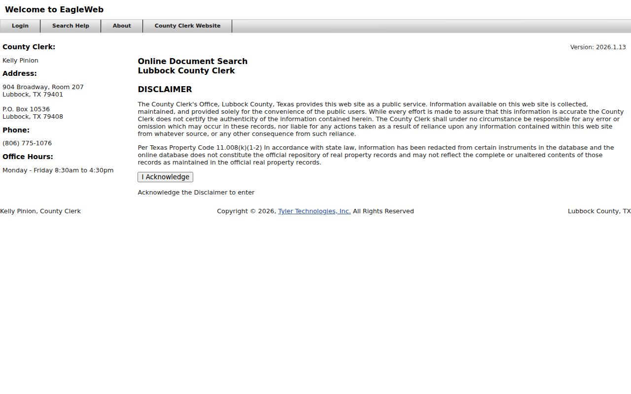
The screen is an entry point, not evidence that an image is complete or that a name proves present occupancy. Preserve the search terms and date used so the recorded result can be checked again at the custodian office.
Match Lubbock Permits to Addresses
City Citizen Self Service adds dated address evidence. Its permit search accepts a permit number, project, or address, and sample results can show permit number, project, address, type, status, and attention reason. The permit record describes a development event, not a resident list. Attribute a person only if the actual record displays that name.
Some plans cannot be reproduced because they are sealed. City Building Safety directs researchers to request a record or arrange viewing when that limit applies. The published statistical series runs from 2015 through the current reporting year, while the start of individual online permit coverage was not verified. For an older Lubbock street, preserve the exact address spelling and use the open-record route if a CSS query does not return a result.
Bridge Older Lubbock Street Names
Older address work needs more than a modern street number. City maps provide Official City of Lubbock Street Names and Block Ranges plus historical annexations by decade and ordinance. Texas Tech's Lubbock Lot Surveys, covering the 1920s through the 1960s, document lot and block changes in Original Town, Overton, and McCrummens. Use the old and current street spelling with subdivision, lot, block, and legal-description terms rather than forcing a historical listing into a current address.
Historic reverse listings are a dated complement to the current street directory. Hudspeth volumes run from 1930 through 1972 and R. L. Polk volumes from 1973 through 2003, with edition gaps and conventions to verify. The historical shelf and access points are described in the Lubbock city directories. A criss-cross entry can identify a listed householder or business at one date; it does not establish every person present.
- Parcel
- A mapped piece of land tracked in the appraisal and GIS systems.
- Situs address
- The physical property address used for map, permit, and street work.
- Plat
- A recorded map that places lots, blocks, streets, and subdivisions.
- Criss-cross directory
- The street-address section of a directory, read with its alphabetic listings and abbreviation key.
Check Lubbock ZIP and City Edges
A Lubbock mailing city and ZIP do not by themselves show that a parcel lies inside incorporated Lubbock. Compare the ParcelMap City Limit, Lubbock County, and ZIP Code layers, then check the appraisal account's taxing and jurisdiction information. This matters most near annexed or county-edge areas, where a postal label can outlast a boundary change.
USPS, rather than the GIS polygon, supplies the final delivery string for an exact address. The map remains useful for a street directory search because it shows which surrounding parcels share a geometry, subdivision, or edge condition.
Lubbock Voter Lookup Limits
Myth: a statewide voter-status screen is not a public list of everyone on a Lubbock street. Texas SOS individual lookup uses a VUID, a Texas driver-license route where supplied, or a first and last name route that also asks for county, date of birth, and ZIP code. A successful result may show status, precinct, and election information, but it is designed to confirm one voter.
A Chapter 18 voter-list request is separate from the online lookup. The current Lubbock form, price, format, and delivery procedure were not located in the inspected county sources. Protected residences and confidential identifiers stay outside a public street roster. County election records and historical poll books may require the Elections Administrator, County Clerk archives, Texas Tech, the Texas State Library and Archives, or newspaper collections.
Lubbock Street Records by Address
Each record below is keyed to an address, parcel, geography, or dated listing. Reading them together reduces a common mistake: treating an owner, a map polygon, or an old directory line as the same kind of fact. The street directory works best as a record trail, with each source checked against its date and custodian.
| Address record | Keeper | What it can show | Access route |
|---|---|---|---|
| Appraisal account | LCAD | Owner, mailing and situs addresses, value, exemptions, legal description, account IDs | Public search, phone, email, office |
| Parcel and GIS layers | City GIS | Geometry, street, subdivision, ZIP, flood zone, and city limit | Public map and REST service |
| Deed and index | County Clerk | Grantor, grantee, date, reception number, legal description, instrument | EagleWeb, counter, archive |
| Plat or map | Clerk, City GIS, TTU | Lot, block, subdivision, road changes, and boundaries | Portal, map service, archive |
| Permit or zoning record | City Building Safety / GIS | Address, project, type, status, and land-use context | CSS, GIS, or records request |
| Historical directory | Mahon / TTU | Dated listed householder, business, and address snapshot | Library, database, archive |
| Federal census | NARA / Census sources | Enumerated household and address geography through the public 1950 schedule | Archive and library databases |
County records in Lubbock also include plats, commissioners-court materials, and official public records. A current map point is a locator, while a certified or official copy must come from the office that holds it.
Read Lubbock Grantor Grantee Terms
The County Clerk's EagleWeb help page explains how more search terms narrow a result and how multiple document types can be selected after clearing Search All Types. A grantor is the party transferring an interest. A grantee is the party receiving it. Those labels point to a transaction, not to a current address list.
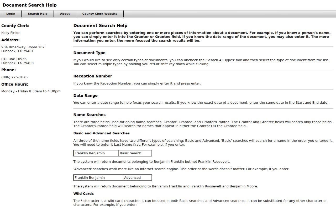
Pair the party search with the legal description from LCAD. That extra term is especially valuable when a Lubbock street number has changed or an older instrument uses lot-and-block language instead of a street address.
Lubbock Street Directory Limits
No public address source is a complete list of everyone connected to a home. Utility customer and delivery information are not public resident searches. DMV address data is restricted under the Driver's Privacy Protection Act. Protected voter records can use an asterisk or alternate address, and a homestead exemption is only a limited ownership signal. Use a parcel owner, deed party, permit record, or historical directory listing for the specific fact it actually records.
Lawful use. Lubbock address records are for personal, lawful research such as family history, estate work, civic questions, or checking a property record. Never use an address trail to stalk, harass, intimidate, or harm another person.